OceanGrafix Other product
CHS Charts
Canadian Hydrographic Service (CHS) charts covering Canada's coastline and major inland waterways.
Description
OceanGrafix offers Canadian Hydrographic Service (CHS) charts, providing commercial and recreational mariners with navigational information for Canadian waters. Coverage includes Canada's coastline, which at 152,100 miles is described as the longest in the world, and its major inland waterways.
Key features
- Official CHS charts for Canadian coastal and inland waters
- Browse by region or search by chart number
- Paper charts to complement electronic navigation and serve as a back-up
Applications
Navigation in Canadian coastal waters, the Great Lakes and major inland waterways.
More from OceanGrafix
Featured products
All products →
System / Package
Supreme 12 VDC - 40 A
Automatic 12 V, 40 A battery charger with three independent outputs, programmable for AGM, GEL, wet and lithium, universal 90–265 VAC input; CE and ABYC compliant.

Software
Onboard IT Networks & IP Telephony (Kerio)
Kerio Control next-generation firewall with VLAN management, MyKerio remote management, usage reporting, and Kerio Operator VoIP phone system for onboard IT networks.
Equipment
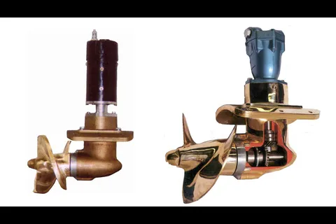
Bow and Stern Thrusters
Full line of hydraulic (5 to 160 HP, 200 to 4,000 lb thrust) and electric (5 to 14 HP, 125 to 550 lb thrust) bow and stern thrusters in aluminum or bronze finish.